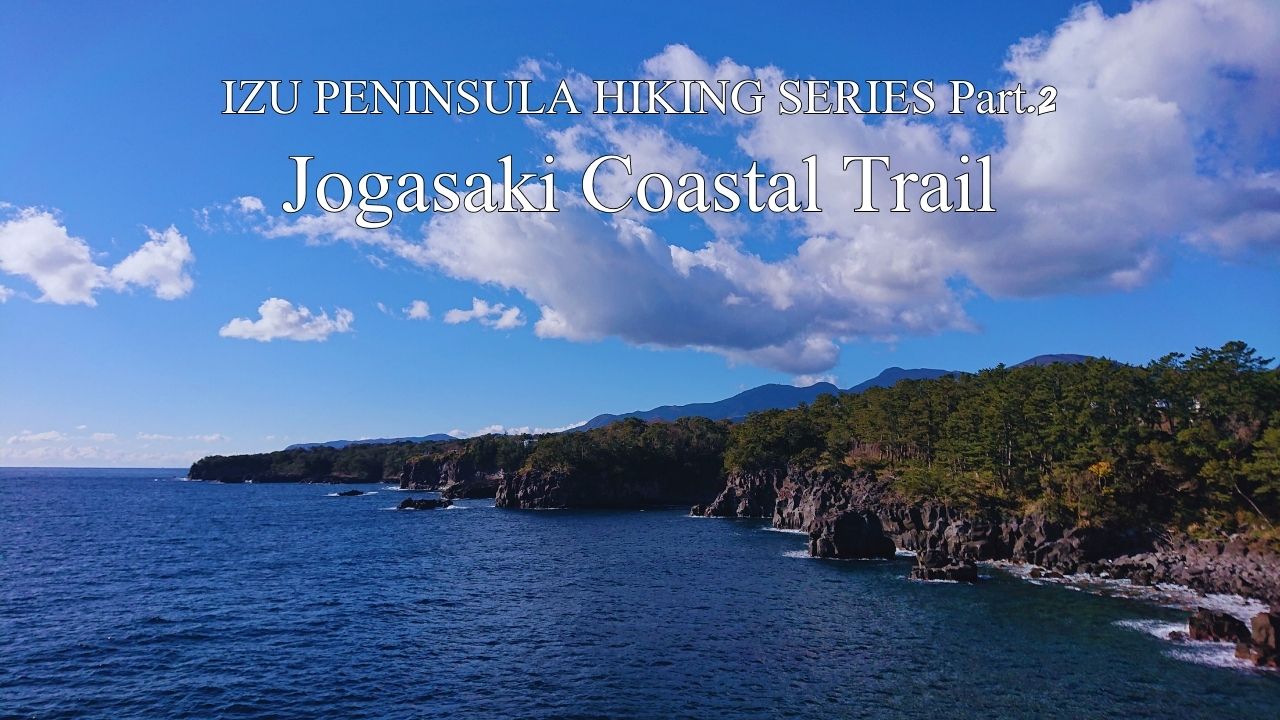
HIKE JAPAN’S IZU PENINSULA SERIES Part.2_ Jogasaki Coastl Trail
Jogazaki Coastal Trail (Ito)
HIKE JAPAN’S IZU PENINSULA SERIES
Izu Peninsula UNESCO Global Geopark
Japan’s Izu Peninsula, just 45 minutes from Tokyo by bullet train, is geographically unique in being the only part of the mainland to sit on top of the Philippine’s tectonic plate. Izu was originally an island located south of the Japanese mainland. The northward movement of the Philippine plate eventually brought the island into contact with the mainland, forming the current peninsula. Understandably, a considerable amount of volcanic activity manifests in this movement, earning Izu Peninsula UNESCO Global Geopark status.
.jpg)
Mt Omuro’s lava flow cooled rapidly when it hit the Pacific 4,000 years ago, causing these vertical splits, easily eroded by the ocean to form today’s spectacular caves and coastline.
A rolling 9km clifftop walk along ancient lava flows. Stunning views of Sagami Bay and breakers rolling in from the Pacific. Enjoy some super-fresh seafood at a traditional eating house along the route. Add an extra couple of kilometres for walking from/to train stations to start and finish your hike. Take in an easy day’s walking, or combine with other Izu routes in this series for a multi-day programme.
Jogasaki Coastal Trail is an excellent opportunity to appreciate the volcanic forces. The walk is over ancient lava flows that have oozed out into the Pacific before solidifying to present form. Dominating the landscape slightly inland from the walk is Mt Omuro with its classic conical volcano shape. The centuries old local tradition of burning off the grass on Omuro’s slopes keeps the small mountain bright green with new shoots through most of the year.
Catch Izu Odoriko train from Tokyo and alight at Izu Kogen station after about a 2 hour journey. The second half of the ride from Atami down the east coast of the Izu Peninsula affords spectacular coastal views from the left-hand side of the train.
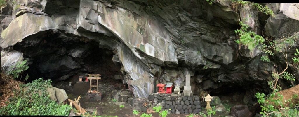
Start your hike by paying your respects at this ancient shrine set in a sea cave in the lava flow.
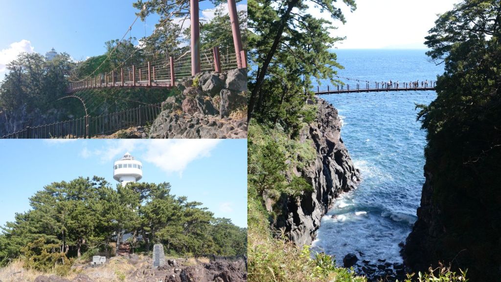
Walk about 15 minutes south from the station and out to the coast to start our walk. Be sure to take the small side-path down to the ancient shrine set into a cave on the shore – it’s well worth the quick diversion. Start heading north along the trail and after about 30 minutes you’ll cross the first of two suspension bridges on today’s walk – good chances to enjoy the spectacularly Pacific-eroded lava flow from above.
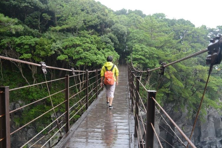
The first of two suspension bridges on today’s walk
You’ll cross a small bridge over Tajima Falls and circle round down to an observation platform to look back at the feature. The river originates up in the Amagi Mountains in central Izu and irrigates numerous wasabi fields on its journey down here to the coast. Wasabi cultivation originated here in Shizuoka Prefecture, thriving on the pure mountain water which rinses away potentially harmful bacteria to the wasabi plants. The waterfall is impressive particularly after it has been raining, and is a spectacle as it tumbles down into the boiling surf.
Your walk continues northwards following the clifftop, through lush, green coastal forest. Sidetracks regularly deviate eastwards out to promontories and sometimes little bays carved into the lava sheet. The cliff-edge is ever present and it’s a 30m drop down to the rocky surf so take care! On the right-hand side of the trail you will come across a rock platform that in feudal times was a lighthouse to coastal shipping. Monks from the nearby temple light a fire here every night to warn vessels to keep their distance from Jogazaki’s unforgiving rocky shore.
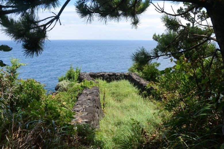
Monks from the nearby temple lit a fire on this century-old platform each night for shipping
The first smaller temple building you encounter by the sea is the original site of the temple, which is dedicated to Buddhist Saint Nichiren who was banished here by the Kamakura Government in the 12th century. Walk a further 5 minutes north and you enter the main site of today’s temple complex. In front of the main temple building is Japan’s eldest Mountain Peach tree (myrtle family), believed to be over 1,000 years old.
Continuing ever northwards from the temple look right to the coast and you will see a pool set amongst the volcanic rockfall, a popular spot for families to cool off in summer. If it’s hot and you have time, why not enjoy a break here yourself?
30 minutes or so walking further north brings you to the site of the second suspension bridge and a modern lighthouse that you can climb to enjoy a 180-degree Pacific view (although at writing closed due to COVID). On a clear day you can see a number of the volcanic chain of Izu islands running down the peninsula’s east coast, which are individually labelled for you in a diorama in the lighthouse.
Carrying on northwards we come across a feudal period short-barreled brass cannon. The Japanese-only sign tells us this was the state of local coastal defenses when in the mid-19th century US Admiral Perry sailed his fleet past here and into Edo (Tokyo) Bay to pressure the Shogun administration at cannon-point to open up to international trade. Of course, gun power had been invented in the orient over a millennium ago, but by the industrial revolution cannon technology in the West advanced hugely. This short-barreled fixed-mount brass cannon was hopelessly out-ranged by Perry’s long-barreled adjustable iron cannons. Thus began the US-Japan relationship. This experience motivated Japan to set up its own reverberating furnace to manufacture iron cannon at Nirayama, now a World Heritage Site just a few kilometres inland from Jogasaki. Thus began Japan’s own rapid industrial revolution to close the gap with the West in industrial and military capability.
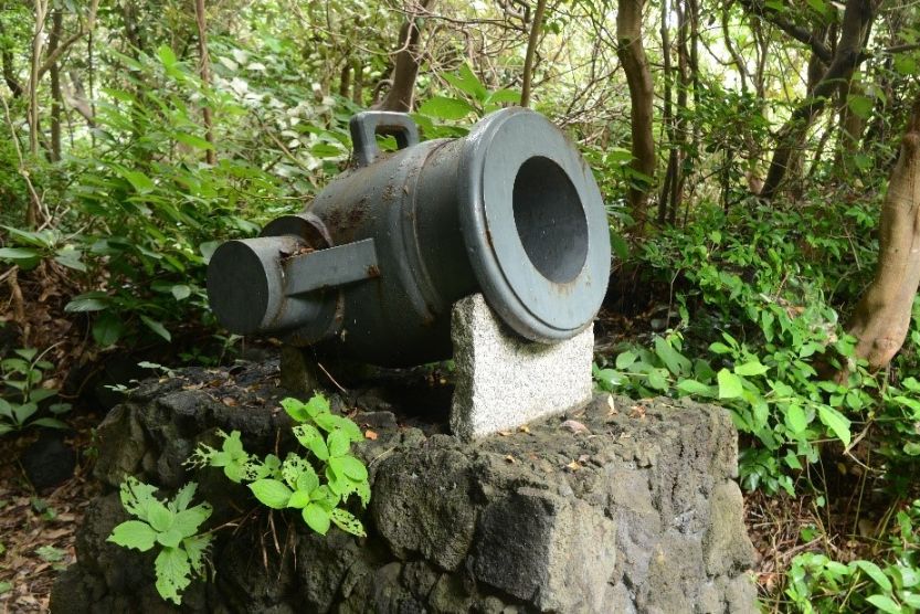
This feudal defensive short-barreled fixed-mount brass cannon was hopelessly outmatched by US Navy’s industrial revolution long-barreled iron adjustable ship-based cannons
By now you’ve been going for about half a day, so perfect timing for your lunch location to appear. Bora Naya is a traditional Japanese restaurant on the coast serving a range of delicacies fished from local waters, ranging from sashimi to seafood curry.
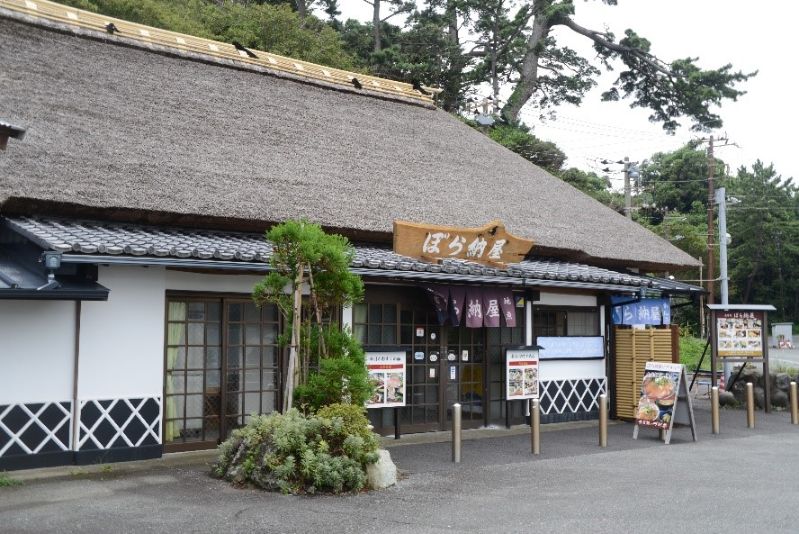
Traditional seaside restaurant Bora Naya serves the fresh local catch.
Just north of Bora Naya take in the 19th century mullet spotting tower precariously perched over the rocky lava flow and surf. Mullet fishing was a lucrative business in the area for a couple of centuries and this tower is the only remaining of a number that were placed along this coast to guide fishermen to the catch.
The trail now brings you out to a paved surface that winds through the cute local fishing port of Futo, complete with several dive shops. A short walk uphill brings you to Futo Station, transport back to Tokyo if necessary, but hopefully you can stay overnight to enjoy more of Izu’s charms the next day.
Jogazaki Coast is great for individual hikers, or if you would prefer a guided hike try Jimmy’s Izu Tours.
Name: Jogasaki Coastal (Kaigan)
Starting point: Izu Kogen Station
Finishing point: Futo Station
Access: Izu Odoriko (JR) from Tokyo
Length: 9 kms 4 hours
Terrain: largely flat over lava flows
Difficulty: Easy walking
Onsen close by: Ito
Other hikes in same vicinity to make multi-day program:
Mt Kurotake Hiking Trail (Atami)