HIKE JAPAN’S IZU PENINSULA SERIES Part.1_ Old Shimoda Foot Highway and Seven Falls
HIKE JAPAN’S IZU PENINSULA SERIES
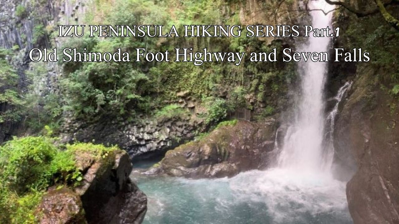
Old Shimoda Foot Highway and Seven Falls (Izu City, Kawazu)
Japan’s Izu Peninsula, just 45 minutes from Tokyo by bullet train, is geographically unique in being the only part of the mainland to sit on top of the Philippine Sea plate. Izu was originally a group of submarine volcanoes located south of the Japanese mainland. The northward movement of the Philippine plate eventually brought the island into contact with the mainland, forming the current peninsula. Understandably, a considerable amount of volcanic activity manifests in this movement, earning Izu Peninsula UNESCO Global Geopark status.
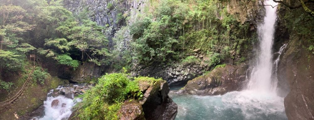
Kama Falls from the hiking trail. Note the 2 different kinds of rocks – smooth ancient strata laid down on the Pacific seabed and above that angular air-cooled lava flows from the Mt Noborio (south) eruption.
Up to 19kms of rolling hiking along river valleys clothed in 19th century indigenous plantation forest. Refresh body and soul in this historical kaleidoscope of gushing waterfalls and pristine ponds.
In feudal times Shimoda Foot Highway connected Izu Peninsula’s southern port of Shimoda with Mishima, about 70kms to the north. After traversing northwards from Shimoda along the central spine of Izu Peninsula, travelers could turn right (east) at Mishima and walk along Tokaido (Japan’s main arterial route then and now, connecting east-west all major cities on the Pacific coast) to the modern capital at Edo (now Tokyo), or turn left to access the ancient capitals in the west of Kyoto and Osaka.
Shimoda acted as a custom’s clearing port for vessels bound for the capital in Edo, so it was a logical location for Japan’s first foreign diplomatic post (USA), headed by New York merchant Townsend Harris in the 1850s. Harris’s mission was to conclude a trade treaty with the closed Edo administration, effectively acting as the follow-up soft-cop to US Admiral Perry’s hard-cop who had scored the first foreign pact with Japan allowing the diplomatic mission at Shimoda. For his negotiations, Harris famously completed the long arduous journey from Shimoda to Edo bouncing around in a palanquin along the mountainous route of our hike. Ironically, it would have been way faster, cheaper and easier just to cross Sagami Bay from Shimoda and into Edo (Tokyo) Bay by ship, but possibly the Edo administration wanted to soften up the inbound negotiator with the hard land route?
Moving into the 20th century, our hike is location for The Dancing Girl of Izu (Odoriko), a block-buster Japanese romantic movie remade five times, both pre and post War. The hiking trail is now named “Odoriko” in honor of the movie, as also is the suave JR train that runs from Tokyo down the east coast of Izu Peninsula to provide your wheels home from the hike.
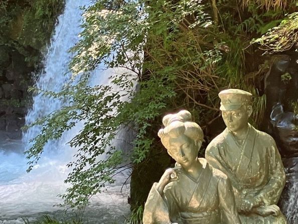
Izu Dancing Girl (Odoriko) with her lover at 7 Falls
Make and early start from Tokyo because we`ve got a lot of ground to cover, catch Tokaido Shinkansen Kodama (the one with the blue signs, don’t mistakenly jump on Nozomi or Hikari with yellow and red signs respectively or you won’t be able to get off possibly until Nagoya!). Can be covered with valid JR pass. After about 60 minutes alight at Mishima Station, switch to local IzuHakone line to head south along the spine of Izu Peninsula to Shuzenji. At Shuzenji Station transfer to Tokai Bus heading further south for Kawazu, alight after about 30 minutes at Joren Falls to begin our hike.
Our hiking route runs north-south along two consecutive river valleys, separated by Izu Peninsula’s tallest mountain, Amagi Range, which runs east-west roughly bisecting our course. Joren Falls is on our first river, Kano River, running northwards from the highpoint further south in our route of Amagi. From the bus stop follow the short concrete path down to the bottom of the falls.We will be enjoying many more waterfalls and water features today which are inaccessible to all but those prepared to hike.
After seeing Joren Falls, back up the concrete staircase, cross the main road (carefully) and pick up the side road which is reasonably well marked as the starting point of Odoriko Trail. Head down the road a little way, hang a right when the sign says to, and soon you are largely alone walking upstream alongside Kano River through cooling native hinoki and sugi plantation forest. An hour or so brings you back to civilization at Amagi Goe roadside rest stop which has a nice display of the series of Odoriko movies. Leave the traffic behind again diving off into the forest once more continuing always south.
You’ll come across “Mountain Shrine”, a delightful tiny Shinto shrine sporting sizable specimens of some of the 9 kinds of trees decreed sacred by the Edo administration (can you identify them?). Apparently once there were more, but regrettably some were harvested to build the battleship “Amagi” as Japan rushed through its late 19th century industrial revolution following the visits of Perry and Harris.
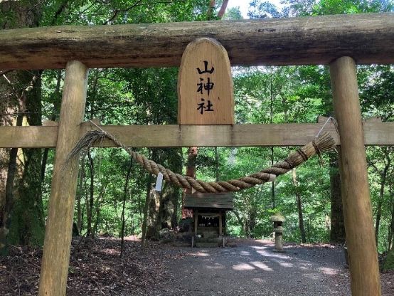
Ancient Mountain Shrine
Walking further south for about half an hour from the Mountain Shrine keep your eyes open on the right-hand side of the trail for remains of a stone cauldron used in feudal times for manufacturing charcoal, the first of a number you will see today. The cauldron remains are a circle of stones about 2m in diameter. In feudal times, the forests of Izu Peninsula were the powerhouse of the capital not so far away in Edo (now Tokyo). Even a few centuries ago, Edo had a population of one million, larger than London and Paris at that time. Understandably Edo’s energy needs were considerable, so by Japan’s mid 19th industrial revolution the mountains of Izu were bare. A massive reafforestation effort commenced resulting in today’s lush forest cover. This became a model for reafforestation on a national scale post WW2 that means Japan now enjoys having 70% of its land area in indigenous plantation forest, highest in the world by far. Great carbon storage and renewable source of fuel and fibre.
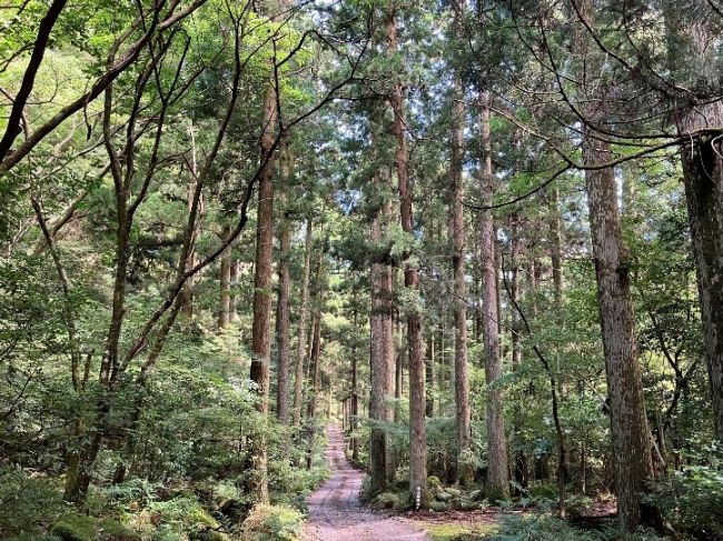
Stroll through 130 year-old Japanese cedar plantations which became a national model for post-War reafforestation
Another hour or so south brings you to a fork in the route. Heading right continues the route of the feudal Shimoda Highway and takes you up high over the Amagi Range peak, although steepness and high rainfall mean the path is now often closed due to landslides. Take the well signposted left fork to wind your way up more gently to the entrance to Old Amagi tunnel, completed in 1905. Japan’s east-west Tokaido main trunk rail line was completed in 1889 linking major Pacific cities Tokyo, Nagoya, Kyoto and Osaka. This meant a fundamental shift in transportation from coastal shipping to rail and road, but folks in the southern half of Izu Peninsula were isolated from be able to participate in this transportation revolution by the Amagi Range barrier. A massive budget would be required for a tunnel so the local assembly member is famously remembered as appealing to the House. Enjoy strolling through the fruits of his efforts to the south side of Amagi Range.
Follow today’s second river (Hontani River) southwards and downhill now with the tunnel (peak elevation for today at about 700m) behind you. Observe wasabi fields alongside the river. Shizuoka is the birthplace of wasabi cultivation, which requires copious pristine water. It takes 2 tonnes of water to produce 1kg of rice, but 30 tonnes of water to produce 1kg of wasabi (not that you would want to eat that in one sitting). Fortunately, Amagi Range is one of Japan’s highest rainfall spots as moist airflow from the nearby Pacific is forced higher and cools as it crosses the Range. Izu Peninsula Geopark’s copious springs fed by plentiful rainfall on the Amagi Range percolating down through volcanic strata provide eternally gushing pure H2O on the scale required by the thirsty garnish.
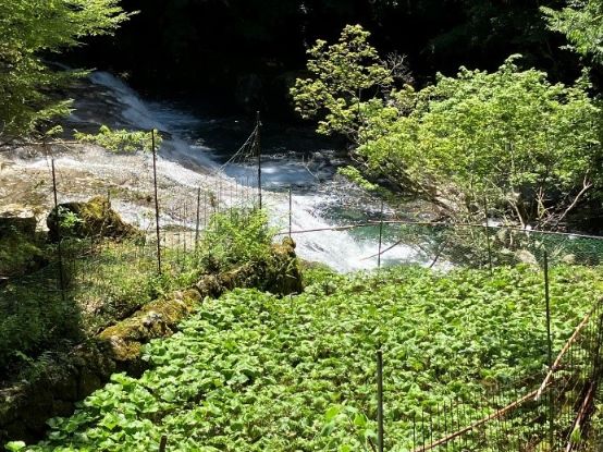
Wasabi growing alongside Hontani River
Keep hiking south along the Hontani River for another couple of hours through impressive Japanese cedar plantations dating back 130 years, and you will reach the entrance to our hike’s climax, 7 Falls. The Falls are created by an ancient eruption from the nearby Mt Noborio (south) volcano and ensuing lava flow oozing out over the top of older strata dating back to the formation of Izu Peninsula on the Pacific sea-bed. At many spots during this final hour of our walk you can see the juxtaposition of these two very different looking strata. The eruption lava flow is angular and cracked as the red-hot material cooled and split in the atmosphere. The older strata underneath the lava flow are smooth after millions of years of sea movement across its surface before being eventually thrust up into current position. Hontani River, enjoying copious rainfall feed from Amagi Range, has carved out these beautiful falls from the two strata from different ages.
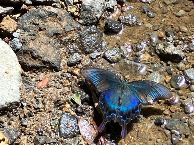
Miyamakarasu ageha butterflies along our route
At the foot of the last of the 7 Falls, the tall, appropriately named Big Waterfall (Odaru), you can enjoy soaking in a natural hot pool reflecting on a great day’s walk (last entry 6pm, closes 7pm, bathing costume required and available for rent). Bus from Odaru Iriguchi (“entrance”) bus stop to Kawazu Station, try to link in with the last Odoriko Express train heading back to Tokyo. Better still, stay overnight at one of the accommodation options around Odaru to enjoy more of Izu’s charms next day.
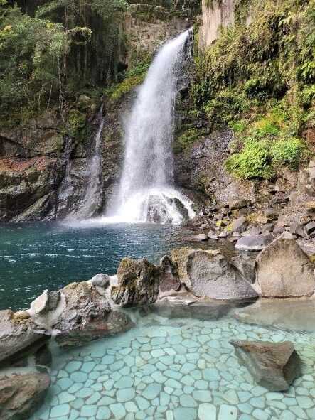
Soak in this natural hot spring at the base of Odaru (Big Waterfall), the perfect finish to your hike.
Name: Old Shimoda Foot Highway (recently known as Odoriko Trail)
Starting point: Joren Falls
Finishing point: Odaru
Access from Tokyo:
Tokaido Shinkansen to Mishima, IzuHakone line to Shuzenji, Tokaido Bus to Joren Falls
Length: Up to 19kms, 8 hours
Terrain: Up and down along two river valleys
Difficulty: Relatively easy
Onsen close by: Odaru Falls
Other hikes in same vicinity to make multi-day program:
Mt Kurotake Hiking Trail (Atami), Jogazaki Coastline (Ito)