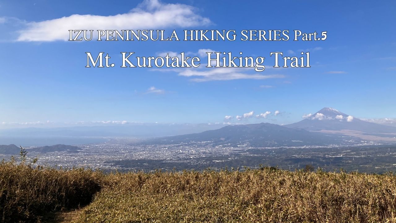
HIKE JAPAN’S IZU PENINSULA SERIES Part.5_Mt.Kurotake Hiking Trail
Mt.Kurotake Hiking Trail (Atami / Kannami)
HIKE JAPAN’S IZU PENINSULA SERIES
Izu Peninsula UNESCO Global Geopark
Japan’s Izu Peninsula, just 45 minutes from Tokyo by bullet train, is geographically unique in being the only part of the mainland to sit on top of the Philippine’s tectonic plate. Izu was originally an island located south of the Japanese mainland. The northward movement of the Philippine plate eventually brought the island into contact with the mainland, forming the current peninsula. Understandably, a considerable amount of volcanic activity manifests in this movement, earning Izu Peninsula UNESCO Global Geopark status.
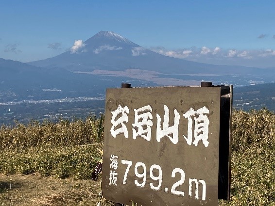
Kurotake Summit. Only in Japan would this not be at 800m!
Great opportunity to summit one of a number of small volcanoes that dot the Izu Peninsula. Atami acts as a gateway to the Peninsula from Tokyo using the super convenient Tokaido bullet train (the other gateway is the next stop on the bullet train line, Mishima). Starting your day from near sea level at Atami Station, you climb first by bus and then hiking to almost 800m before descending. A loop at the top of the trail from Kurotake summit around Kori (“Ice”) Pond at 630m provides some variety for your return route. Nice views of Mt Fuji from upper reaches of the trail, weather permitting of course. Chances of seeing Mt Fuji increase in the winter as the cold air is unable to hold much cloud-forming moisture.
After alighting from the bus walk about 25 mins uphill through the local village streets to reach entrance to the hiking trail. If you have come by car there is a carpark at the trail entrance for 500 yen (honesty box, shows how safe Japan is). A poster board of local schoolchildren’s art reminding visitors, in Japanese only, to take care not to start forest fires is a welcome hint that even this close to Tokyo, you are unlikely to see other international visitors on this route.
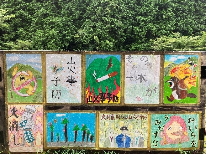
Art from local school reminds visitors to be careful not to start forest fires.
The first 25 mins of the hiking trail follows a usually dry streambed uphill so is not too steep. Enjoy some cool volcanic boulders of reasonable size lying in the streambed, a constant reminder of the fiery beginnings of Izu Peninsula. The trail charges up almost in a straight line through plantations of indigenous hinoki trees. 70% of Japan’s land area is in plantation forest, one of highest in the world. Great carbon storage and renewable source of fuel and fibre.
You’ll reach a bridge crossing a local road that looks like it has been built for tanks, rather than hikers, to cross. A quaint throw-back to Japan’s bubble era (1980s) when money grew on trees. That bridge isn’t going away in a hurry. On the other side of the bridge carry on up the dry steambed about another 15 mins. Then your work really begins as the trail starts to zig-zag up across the contour lines towards our summit destination. 20 minutes of this brings you to a welcome little clearing with a gorgeous view eastwards back across Atami City, where we began our day, and Sagami Bay (of course Pacific Ocean). Good spot for a drink break.
Heading off and upwards again, you’ll be refreshed with a couple hundred meters of flattish terrain as you leave the treeline below you. You’ll come to a fork where a sign invites you either to push on up to Mt Kurotake summit, or go the other way to Kori Pond. Recommend you head to the summit for now, we’ll pick up Kori Pond after that.
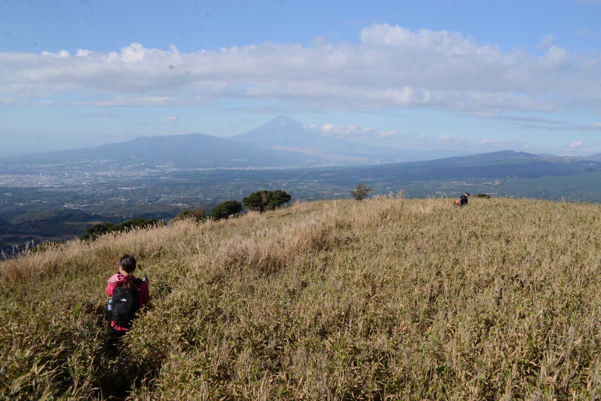
The last few hundred metres to Kurotake summit is pretty steep so a hiking pole earns its value particularly after there has been rain, as the volcanic clay underfoot becomes as slippery as ice in these conditions. Also, you have left forest cover below, so in the summer the cutty grass is prolific and you will be pushing your way through the stuff over your head, even on the maintained trail.
One last push through the cutty grass and, voila, you have summited Kurotake at 799.2m as the welcoming sign announces. Yep, not 800m, this is Japan and we take precision seriously, just as the trains depart at 7:59, not 8:00.
Our trail pushes through thick bamboo above the treeline
Your effort is well rewarded by a 360 degree view clockwise across Mt Hakone to the northeast, Atami City to the east, Sagami Bay to the southeast, Izu Peninsula itself stretching away to the south, Suruga Bay and Mishima City to the west. Oh, and yes, if you have picked a clear day then also in the west is a great view of the grand lady herself, Mt Fuji. Often you can enjoy paragliders riding the thermals very close to Kurotake summit.
When you are ready for more exercise take the other exit off the summit, still heading west. Its steep downhill again for about 20 mins so you’ll be glad of the ropes laid out for you. You’ll suddenly run into Izu Skyline, a toll road for cars only and walking is prohibited. So, cross the road carefully and pick up the trail again on the other side. Once again you are heading downhill through often head-high cutty grass and bamboo thickets. Another 20 mins will bring you to the shores of Kori Pond, an unexpected piece of permanent still water way up here at 630m. Another good drink spot. If you are imaginative and the weather is clear, tilt your head at the right angle and you can see Mt Fuji reflected in the pond’s surface. Kori means ice so whilst winter is the best time for Fuji viewing, please be warmly attired if you pick this season.
 Fuji rise above Kori Pond
Leaving Kori Pond wind your way along a different route back to Izu Skyline. You’ll be amazed by a series of concrete tunnels constructed back in the bubble just for hikers to avoid having to mix with the high-speed vehicular traffic on the Skyline. Head steep uphill again for about 20 mins (you’ll be glad of the ropes), and behold you have returned to the fork you passed through earlier, before your final assault on Kurotake summit. This time head downhill and it’s all familiar territory to our hike’s starting point.
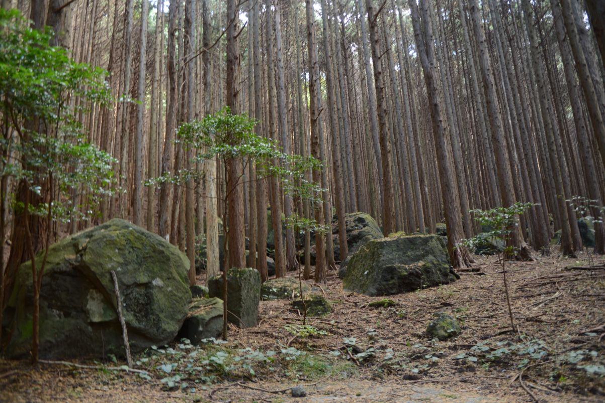
Massive volcanic boulders scattered amoungst plantation forest, Mt.Kurotake western slope descent
An alternative option from Kori Pond is to keep heading westwards and down the western slope of Mt. Kurotake. You’ll pass through healthy plantation forest sprinkled with giant volcanic boulders. About 1 hour of walking from Kori Pond will bring you to the western base of Mt Kurotake and out through some cute local farms to the main road. From here you can bus, or call a taxi, to Kannami Station on the Tokaido main trunk line, returning 1 stop to Atami Station where you began your day.
Name: Mt. Kurotake Hiking Trail
Starting point: Mt. Kurotake Hiking Trail Entrance
Finishing point: starting point above
Access: Catch Tokai bus from Atami Station platform # to Kurotake Hiking Course Entrance (20 mins). Walk 25 mins from bus stop up a sealed local country road to trail start.
Length: 9 kms 5 hours
Terrain: steep in places although ropes are in place to assist on slippery days after rainfall
Difficulty: Medium
Onsen close by: Atami
Other hikes in same vicinity to make multi-day program: